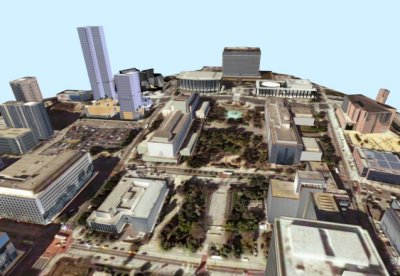
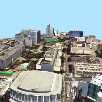
The Annenberg Center for Communication provided a grant to fund the development of 3-D tools that allowed people to explore the physical location of the Grand Avenue park virtually. USC’s Integrated Media Systems Center (IMSC) developed these applications using their own GeoDec (Geospatial Decision Making) technology, whose development was sponsored by the National Science Foundation. We showcased an enhanced, graphically accurate 3-D model of the park site at the prestigious Entertainment Gathering in Los Angeles. You can view a compressed video here:
In April 2006, Frank Gehry’s team unveiled designs for Phase One of the $1.8 development bordering the park site. The GeoDec team augmented its model of the park with Gehry’s designs (thanks to Jason King for building those models), making it possible for the public to see how the development will transform the area across from Disney Hall and next to the park. Abundantly clear in the video were the line-of-sight issues from the Grand Avenue Park. The County was exploring the possibility of razing the Stanley Mosk County Courthouse, which lies between the Phase One Development and the park, and the Hahn Hall of Administration, located between the park and the Cathedral of Our Lady of the Angels: the GeoDec team generated models both with and without the Courthouse and Hahn Hall. Videos of the models debuted at a public event at the Los Angeles County Museum of Art. You can see compressed video here:
Explore the Park with Google Earth
Based on Google Earth, our Web-accessible interface allows public users to interact with a 3-D model of the proposed park area that has been enhanced with maps, road information, still photos, panoramic images and historical information about the unique art and architecture in the area. IMSC’s Information Laboratory (Infolab) implemented this Web-based tool.
Installation is quick and easy. By installing Google Earth, you’ll not only be able to fly through the Grand Avenue Park site, you’ll also be able to view 3-D images of sites all around the world.
1. Install Google Earth
2. Click here to view the Grand Avenue park site

A view of our 3D rendering of the park including Gehry’s new buildings.
Background
USC’s Integrated Media Systems Center, in collaboration with the Annenberg Center for Communication, provided an information rich, realistic 3-D environment for the Grand Intervention project using GeoDec (Geospatial Decision Making) technology. Based at IMSC, this collaborative project included Dr. Cyrus Shahabi, Dr. Craig Knoblock, Dr. Ulrich Neumann, Dr. Ramakant Nevatia and Dr. Suya You. The applications allow navigation through 3-D models and enable users to ask queries and get information about a geographic area in a convenient way. The recent increase in the amount of geo-spatial information and its broader availability has motivated the effort to integrate this data for a comprehensive set of queries in different modalities. The goal was to create realistic 3-D visualization tools that incorporate the visual appeal and accuracy of graphic imagery with detailed attribution information.

A view of our 3D model of the park from behind the Dorothy Chandler Pavilion.


